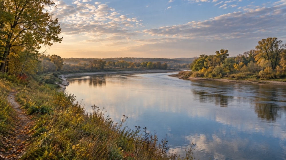
A capital shaped by water and woods
Lansing occupies a low, gently rolling landscape organized by water. The Grand River makes a broad loop through the city, while the Red Cedar River and Sycamore Creek meet within an extensive floodplain. Those waterways did more than furnish a scenic setting. They influenced where mills, bridges, streets, parks and early settlements could take hold. Better-drained ground carried oak and maple, while wetter bottomland favored elm and soft maple. The resulting contrast—wooded ridge, open floodplain, slow channel and urban street—still provides the clearest way to understand the place.
For orientation, begin with a relationship that is visible on the ground: a street approaching a bridge, a row of trees following a block or an open slope beside the river. Then compare it with the neighboring space. The contrast between a regular grid and a curving bank explains more than either view alone. The guide to walking and riding Lansing’s river corridor follows those transitions at path level. A map gives the larger pattern, while the sequence of crossings, open ground and wooded edges gives it a recognizable shape. Reading that sequence connects the landscape pages with the neighborhood and history pages.
The decision to move Michigan’s capital to Lansing Township in 1847 put a new civic center into a landscape that already had small river settlements. A planned community called the Village of Michigan joined a lower, middle and upper village. Bridges helped those pieces function together; rail connections later tied the young city to a much wider region. Lansing incorporated in 1859 with roughly 3,000 residents, then expanded through industry, government, neighborhood building and repeated annexation.
History on the ground
This guide treats history as something visible in the city’s shape. In North Lansing, a commercial district grew near an early dam, sawmill and river crossing. Around the middle village, the capital decision concentrated commerce and public life. On residential streets, mature trees trace generations of planting, loss and renewal. Along the river, parkland and trails turn the floodplain into a connected civic landscape. Each subject becomes more useful when placed beside the others.
Two long historical threads run through the guide. The first is settlement and expansion: the three villages, the 1848 Michigan Avenue bridge, incorporation, rail growth, industrial expansion and the annexations that more than doubled Lansing’s land area during the mid-twentieth century. The second is stewardship: early shade-tree protection, planning for parks, the response to Dutch elm disease, riverbank improvements, recycling and the difficult work of caring for a built environment over time.
Places that tell the story
Several places recur because they illuminate different parts of Lansing’s character. Turner-Dodge House sits in the story of Old Town and the river bend. Fenner Nature Center represents the meeting of woodland, field, wet ground and environmental learning. Potter Park belongs to the river corridor and the city’s long recreation history. Cooley Gardens and the rose garden and woodland trail at Frances Park show a more cultivated side of the park system. The municipal golf courses, community centers and Scott Field broaden the picture beyond a few celebrated sites.
The Lansing River Trail is the most direct connective line. It follows the Grand and Red Cedar corridors, allowing the same urban landscape to be experienced at walking or riding speed. A person moving along it encounters water, tree canopy, open park, bridge approaches and neighborhood edges in sequence. The trail is therefore both a route and a way of reading how separate parts of Lansing touch.
Civic structure without civic instruction
Lansing’s municipal history includes a mayoral executive, a legislative council, a clerk, courts and departments concerned with finance, public works, parks, planning, safety and neighborhood conditions. This guide explains those relationships only as background. It does not publish notices, procedures, transactions or current requirements. Those change, and they belong on the municipality’s official website linked in the footer.
That distinction matters. A civic reference can explain why code, planning, public works and preservation developed without telling anyone how to file, pay, register or report. It can describe the existence of local revenue functions without quoting current figures. It can discuss the history of waste collection without presenting routes or calendars. The purpose here is orientation: how the city took shape, why its landscapes matter, and how to recognize the historical layers that remain.
Read across subjects rather than treating each page as a sealed category. River geography helps explain settlement, parkland and industry; annexation helps explain neighborhood variety and the changing scale of tree care. Those connections are the guide’s central thread.